The History Anorak

The History Anorak
Showing posts with label medieval. Show all posts

Sunday, 8 October 2017

Leicester Streets

A bit of Medieval Leicester - the Guildhall
One of the newest parts of Leicester city is the High Cross shopping centre. It's massive, modern and shiny, but bears the name of a Medieval tall cross that stood at the top of the High Street.

Medieval Leicester had four main entrances called (unimaginatively) North Gate, South Gate, East Gate, and West Gate. High Street ran across town from North Gate to South Gate and, true to its name, was higher than all other streets because it was paved.

High Cross stood at the heart of trade and was the site of the Wednesday Market where country folk would bring produce to sell to the locals. By the 14th century there was enough trade to justify a regular Friday market too.

In 1577 a structure, which became known as High Cross, was erected in the area. It consisted of eight pillars topped by an eight-sided dome and must have been quite magnificent, but the march of progress and increasing size of carts meant it was knocked down in 1773 in an early road-widening scheme. A single pillar survives and now stands in Jubilee Square.

There are many information boards around Leicester that tell you about the area you're in. High Cross is close to the Medieval heart of the city and a board close to the new shopping centre gives details of local street names and their derivations.

Here's a few:

Cank Street. I've never encountered 'cank' before but the board says the street is named after a public well that stood there.

Holy Bones. What a great name. It might have something to do with the graves in nearby St Nicholas Church. Sadly it might be a Medieval joke about the number of butchers that could be found around it.

Gallowtree Gate. You might remember from a recent York post that gate means road, or way. (From the Old Norse 'gata'.) Gallowtree is fairly self-explanatory. It's where public hangings took place on the gallows 'tree'.

Sanvey Gate. Another 'gate', but the Sanvey bit is believed to be a corruption of Sancta Via, or holy way. It possibly marks the route of old religious processions through town.

And for any teenage boys out there, here's a chance to snigger.

Butt Close Lane.  Butts were, of course, the place where archers practised their skills. You can stop laughing now!


Saturday, 15 August 2015

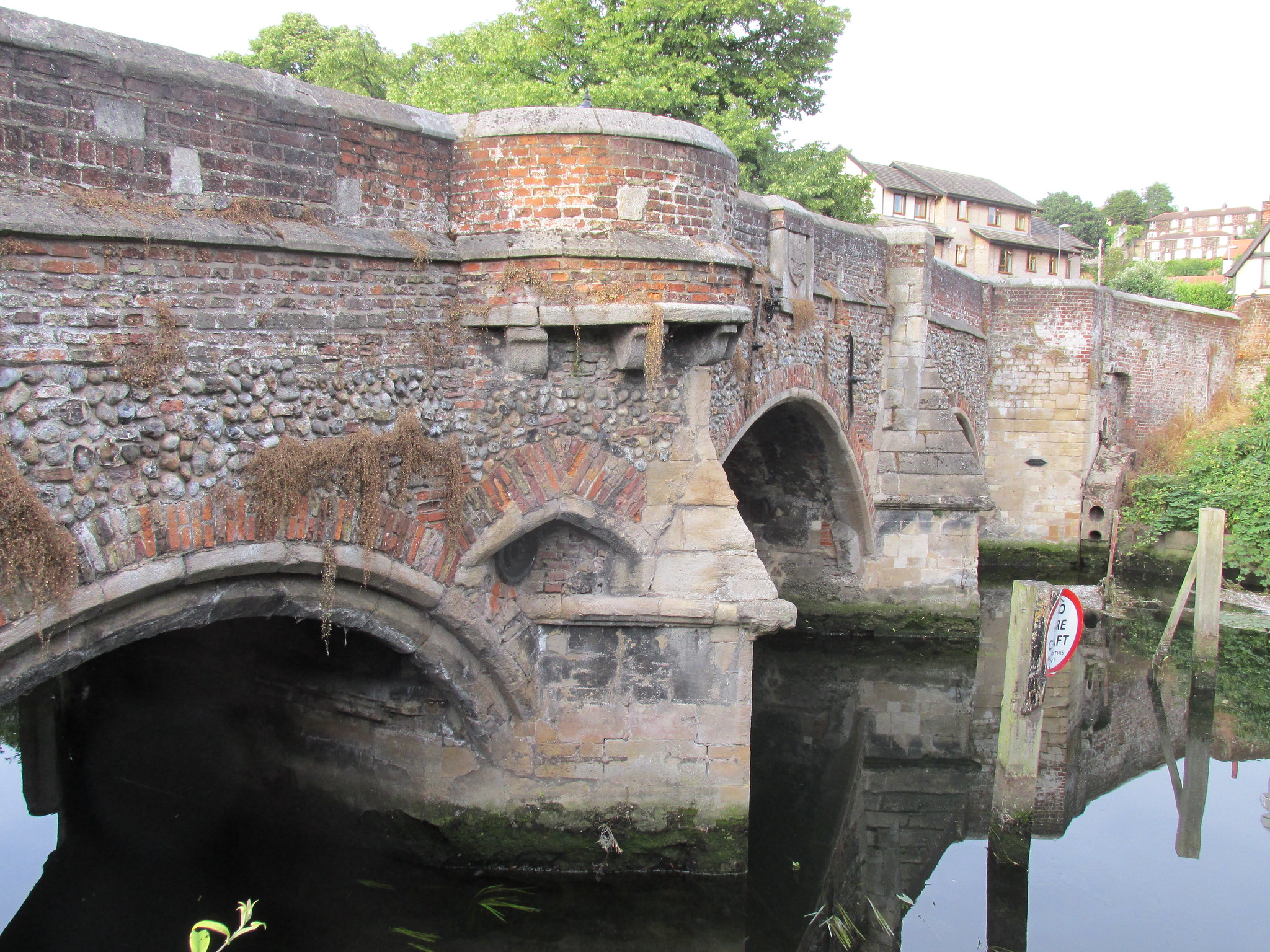
Bishop's Bridge

In a recent post about Norwich I mentioned Bishop Bridge and then realised I hadn't shown you a photo of it. It's a wonderful medieval packhorse bridge over the Wensum and is worth a detour to see.  A plaque on the side says it was built in 1340 and that the Earl of Warwick's troops fought a battle nearby in 1549.
Grade II* listed. 

Friday, 24 July 2015

Cow Tower

Cow Tower in Norwich is considered to be one of the finest surviving examples of medieval brickwork in the UK.  It stands by a bend in the River Wensum and we discovered it by accident during a post-prandial stroll. If you're ever in the city it's worth checking out the riverside walk because there are several interesting things to spot along the way and I'll be showing you some of them in future posts.

The tower was built as an artillery blockhouse and is one of the earliest examples. It was constructed in 1398-9 to command a strategic point in the city's defences.  At the time Britain wasn't very friendly with France. A French raid had devastated Southampton in 1338, and the Peasants' Revolt of 1381 had left Norwich badly damaged. So Cow Tower could serve a dual purpose to protect the city from attacks both inside and out! It would have housed a garrison when necessary.

Norwich was walled (mostly demolished to make way for expansion in the 18th and 19th centuries) and Cow Tower strengthened those defences. It was equipped with hand cannon and bombards (large caliber, muzzle-loading artillery pieces. Gives rise to the title of Bombadier.)

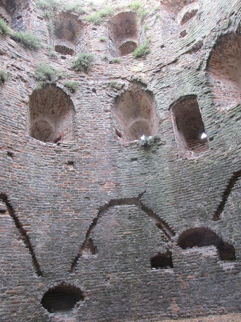
Cow Tower interior
Cow Tower is quite big. It's 14.6 metres (48 ft) high, 11.2 metres (37 ft) across, and the walls are 1.8 metres (5 ft 11 in) thick at the base. The brick facings have the local flint building material in their core.

It had three floors, all now sadly missing, and a staircase up the side to reach them. It takes its name from the surrounding Cowholme area, meaning a water meadow where cows are grazed.

It's now a scheduled monument in the care of English Heritage. You can't go in, but you can see the interior clearly through the original (barred) doorway.

For a detailed review click here.